City Council Approves New District Map
At the June 6, 2022 Council Meeting, the City Council adopted Ordinance 2022-13 amending Chapter 2, Article V, Section 2-146, "Voting Districts".
Due to the significant growth in the City’s population over the last 20 years and to ensure fair apportionment in population, it was necessary to review voting district boundaries. The City contracted with Florida Atlantic University (FAU) to conduct an independent review and analysis of the City’s voting districts based on the population results of the 2020 census.
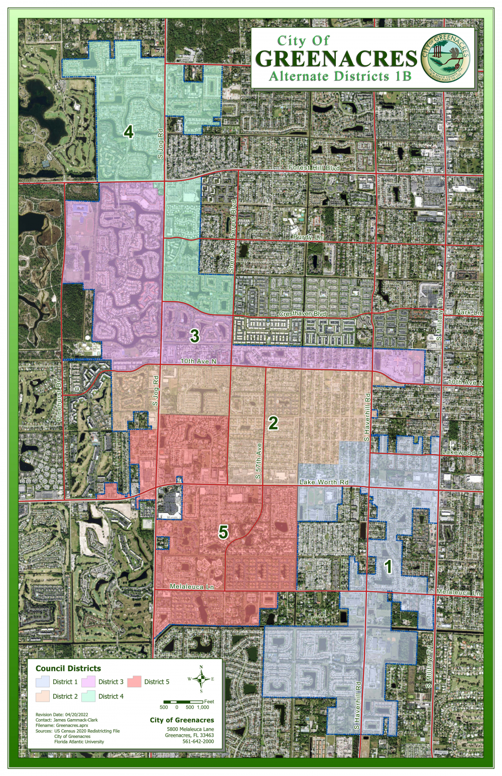
After review of FAU’s analysis and recommendations, the City Council has determined that it is necessary to amend the City’s voting districts to ensure compliance with state and federal law. Council has selected map 1B which can be found in an attachment below.
Below are the new boundaries by district:
DISTRICT I - All property north of Nash Trail, west of Military Trail, east of Nautica
Isles West PL 3 and south of Boatman Street.
DISTRICT II - All property north of Lake Worth Road to 10th Avenue North, west to
include Park Pointe and Lucerne Park and east of Haverhill Road to MODEL LAND CO SUB subdivision.
DISTRICT III - All property north of 10th Avenue North to Forest Hill Boulevard, south
of Cresthaven Boulevard, west to Pinehurst Drive and east to John I. Leonard High School.
DISTRICT IV - All property east of Jog Road from Cresthaven Boulevard to Forest Hill
Boulevard, including three northwest corner parcels located in the Riverbridge Centre
Plaza. All property north of Forest Hill Boulevard.
DISTRICT V - All property north of the L-14 canal, west of the E-3 canal north of Lake
Worth Road to the L-11 canal, west of Sherwood Forest Boulevard and Via Poinciana to
the west.